Thursday, November 26, 2009

Livingstone, I presume

We were expecting the river crossing into Zambia to take anywhere from a 1/2-hour to all-day after we arrived in the Intrepidmobile to wait for the ferry. All the truck traffic that used to go through Zimbabwe on its journey from South Africa to other parts of southern Africa now lines up for this one border crossing as fuel is more reliable in Zambia. We were told trucks wait anywhere from a day to weeks for the appropriate paperwork to get across the ferry into Zambia, and that sometimes after having been there for days the truck drivers may block the road out of frustration. Naturally this would have made our crossing more difficult.


Ferry used to cross Okavango River in Botswana (similar to the one mentioned in this post).

Fortunately, we had had an early start (6:30am) to try to beat the crowds… and it worked. Lickety split we were through Botswanan customs, waited 20-minutes for a ferry for us ,twenty schoolchildren, the Intrepidmobile, and two other cars to board, and we were on the other side in Zambia. Once through immigration, Carissa and I got to see what would become the one souvenir we would most frequently be solicited to buy—Zimbabwean currency. The largest note, One Hundred Trillion dollars, was practically worth nothing even when in use, but since Zimbabwe has abandoned their own currency in favor of the US dollar it has become a popular souvenir (or so the masses of men selling these bills on the street would like you to think).

We followed the Chobe River as it became the ‘mighty Zambezi’ and on to Livingstone, Zambia, where we camped near Victoria Falls. The river and falls separate Zambia from Zimbabwe and unfortunately Zambia gets the short end of the stick. The waterfalls on the Zambian side only flow powerfully in the height of the rainy season and wane between rainstorms. We visited the Zambian side on our arrival. It had been raining for the previous 3 days so the falls looked magnificent (though still a dry season flow).


Rich and Carissa at Victoria Falls (Zambia side).


Victoria Falls (from Zambia).


Us just above where the Zambezi plummets over the falls in Zambia.


Magnificent Victoria Falls.

A few days later when we crossed into Zimbabwe to try out the view from the other side, Zambia’s falls had obviously waned. In contrast, the Zimbabwean side was mighty and massive. Some sections of the falls were 93 meters tall and spray from them obscured the sky even from the opposite lip. There’s a bit of hype around which side of the falls is better, and whether its ‘worth’ the cost of the Zimbabwe visa to see the falls from that side, but our vote is a resounding yes – the views were just more breathtaking.


Devil's cataract (a portion of Vic Falls) on the Zimbabwe side.


Rich swinging from a very strong vine in Vic Falls NP, Zimbabwe.


Carissa and the massive Vic Falls (Zimbabwe side).


Rich just above the Boiling Point on the Zimbabwe side (with the much smaller Zambian falls in the background).


Since Zimbabwe’s tourism has declined in recent years, Livingstone, Zambia has taken on the mantle of Victoria Falls’ main town (replacing Zimbabwe’s Victoria Falls town as the tourist hub). Livingstone is 11-kilometers from the falls and less convenient than the town of Victoria Falls in Zimbabwe which basically overlooks the river. We stayed there in Livingstone for two days after we parted ways from our Interpidmobile friends. Passing up the opportunities to go river rafting or bungee jumping, we instead spent our time looking around the markets and managed to catch a Saturday morning anti-domestic and child abuse rally. Interspersed with dancing, there were speeches and educational skits to hammer home the point.

Our accommodation was a backpackers hostel named Jolly Boys. We’d describe it as a budget resort as it was the nicest hostel at which either of us has ever stayed. It had a friendly staff, great facilities including a pool and bar, and on Saturday night had a traditional drumming and dance show outside the kitchen where we prepared our dinner. Very fancy.

Indeed we’ve cut the apron strings with the Intrepidmobile and are traveling on our own using public transit. We’ll see how this compares...

Tuesday, November 24, 2009

Briefly boating through Botswana

The Okavango Delta of northern Botswana is a 16,000 square kilometer area of beautiful river and creek channels through marshland. The Okavango River begins its journey in Angola and the waters of the rainy season there take three months to make their way through Namibia and into the floodplains of Botswana. We are told that it is the only river in the world that terminates into the middle of a landlocked country; its waters just seep into the Kalahari desert.

Although we experienced some monstrous thunderstorms in northern Namibia, the water from those rains have not yet made it to the Delta so there are fewer lagoons and channels. This was to our advantage.

Our group disembarked from the Interpidmobile and climbed into mokoros (2-passenger, one-poler dugout canoes) to travel to our camp an hour’s journey away. Bayju, our poler, taught us about the birds and trees of the Delta as we cruised among the papyrus stalks and grazing cattle waded in front of us. It wasn’t until we were close to our destination that he revealed to us that the channels we had been travelling through were maintained by hippos, and then we heard them. A big pod of maybe 60 animals were grunting and cavorting in the lagoon near our campsite. After setting up camp (on dry land), we returned to the lagoon to watch the sunset at eye level with the the hippos and crocodiles.


Cow grazing in the delta.


Hippo showing us his teeth before sunset, Okavango Delta.


Sunset from our mokoro, Okavango Delta Botswana.

As we sat around the campfire that night, a lightning storm lit up the sky around us in every direction as if we were in its eye. The rain never came, but the flying termites sure did. We were getting used to these rainy-season visitors by this point: we had watched their evening ritual of emerging from their 6-ft tall nests after dark to mate and head off into the world to make new colonies since leaving the deserts of Namibia. Much like moths, thousands of these 1/2-inch flying insects bombarded us (flying into the backs of our heads) as we sat next to the campfire. Our plan was just to keep them out of our shirts and let them be, but our polers rapidly dug a hole to collect them in for a meal at some other time. We are told they are delicious rainy-season delicacy once pan-fried.

The mokoro was our main way of getting around the Delta and after three days. Once back on the Intrepidmobile we traveled on to Chobe National Park in northeastern Botswana. Chobe is renowned for its elephant herds, so we were excited as these big beasts had eluded us for the most part when we were Etosha National Park (in Namibia). We were not to be disappointed as we found a few herds near the main roads even on our way into the park and our campsite near the Chobe River on the outskirts of the border town of Kasane. On the morning of November 23 we went on an early morning game drive (Beilttog sibs: the vehicles were exactly like the ones from the Indiana Jones ride at Disneyland) where we saw some creatures, but it was the evening boat cruise on the river that really yielded great animal watching. Groups of hippos were up out of the water grazing on the river banks, each with an egret following along to munch up the upturned bugs. Although most of the hippos paid us no mind, it was crazy to see some of them sprint full speed back to the safety of the water, crashing into it with a big Hippo grunt. We were lucky enough to find three groups of elephants down at the river drinking their daily water ration (up to 50 gallons for the big matriarchs), playing in the mud, and socializing. There were quite a few super-adorable baby elephants with their mothers.
Chobe NP and the town of Kasane –near the junction of the four countries of Namibia, Botswana, Zambia, and Zimbabwe – were our last taste of Botswana. From here we crossed the river into Zambia.


Big bull elephant, Okavango Delta.


Baobab tree at the Botswana/Namibia border.


Warthog at our campsite near Chobe National Park, Botswana.


Warthog family cruising the parking lot near the grocery store in Kasane, Botswana (near Chobe).


Hippos (and their egrets) grazing along the Chobe River, Botswana.


Elephants along the Chobe River.


Wednesday, November 18, 2009

North through Namibia

Today is our last full day in Namibia as tomorrow we will cross the border into Botswana and head to the Okavango Delta. For now we are camped along the Kavango River 4km outside the city of Rundu in the very north of the country near the border with Angola. It’s a more populated area than we are used to in this country. We are told that this is because the area has been largely settled by Angolan refugees from their civil war.

Over the last week, travel from Swakopmund has been through desert and largely on gravel roads. The major stops we’ve made have been to visit the Cape Cross Seal Colony, Spitzkoppe mountain, Etosha National Park, and the Grashoek village of the San Bushmen people. At times we’ve felt like we were melting with temperatures up to 95 degrees Fahrenheit, but as we continue north we are heading into the rainy season and colossal thunder storms have been greeting us in the afternoon.

The Cape Cross seal colony just north of Swakopmund, Namibia is home to 80-100,000 Cape fur seals. We were fortunate to visit during the time of year when many pups are born – prime time for males to be defending their territory and harem. The pups were adorable, making ridiculous lost-lamb bleating noises and trying to scoot about on the sand. The enormous males, about 3 times the size of females, clumsily bulldoze over anything or anyone in their path while they bark and defend their beachfront property.


LOTS of Cape Fur seals at Cape Cross, Namibia.


Mama seal and pup.


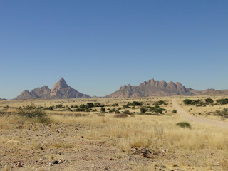
Spitzkoppe and its neighboring mountains rise out of the desert 700 meters without any surrounding foothills for a total height of about 1700 meters.. Yellow in appearance they are a granite made of much more quartz and feldspar than mica, but very grippy under the soles of your shoes and fun to scramble up. We spent 5 hours one morning climbing nearly to the top of one monolith with two friends before finding the route impassable and the day too hot to find another way. The succulent plants, trees and cactuses that we passed on our climb continue to remind us of Dr. Seuss illustrations.


Spitzkoppe and surrounding mountains.


Rich  hugging a cactus.


Carissa's favorite Dr. Seuss tree.


Etosha National Park is a 22,000 acre reserve for wildlife in the north-central portion of Namibia. It is centered around a 60 km-diameter salt flat (the Etosha Pan) that was dry for us, but in the rainy season is a briny lake that attracts thousands of flamingoes. The surrounding bush is savannah and scrubland. We stayed in two separate campsites that were quite luxurious by our American-National Park standards as they are marketed as wildlife resorts. Swimming pools helped us cool down after the log days and flood-lights on the adjacent water-holes allowed us to see the visiting nighttime beasts. Black rhino, some elephants and giraffe were the most frequent visitors we saw at the water-holes. Lions lurked in the darkness making eerie calls – a strange sound to be awakened to in the middle of the night.


Elephants and a rhino in the flood-light waterhole - Etosha NP.


Floodlit rhinos.

During the daytime, while touring in the Interpidmobile, we saw tons of antelope species and were lucky to see three huge prides of lions. Two of these groups were feeding while we watched—one on a rhino and the other on a zebra. The cubs playing around their parents were of course lots of fun to watch.


Sunrise at our campsite in Etosha National Park.


Female lion and cubs on a rhino kill.


From left to right: springbok, oryx, zebra, wildebeest, oryx.


Old-man Kudu.

 
Pumba (warthog) in a water hole.


Oryx

 
Lions near a zebra kill.


Approaching storm in Etosha.

Yesterday (Nov 17), we visited the village of Grashoek . Approximately 6 km from the main (packed gravel) road on a sandy track just wide enough for the Intrepidmobile is a community of approximately 200 San people who reside here after being relocated from the Namibian desert and stripped of hunting privileges. The San were traditionally a nomadic, hunter-gatherer people and are perhaps most famous in Western culture for their clicking-language and their (questionably realistic) role in the movie The gods must be crazy. To supplement the community’s income they have created a ‘living museum’ which provides some insight into what the San traditional way of life had been, and how different practices have been integrated into their modern lives. Though hunting is illegal, gathering is still a big part of their subsistence. We went on a bush walk and learned of the many uses of different plants for food, water and medicine.


San bushmen in traditional dress demonstrating how to make fire.


At night we watched traditional dance performance. Singing and clapping maintain the rhythm as a healer demonstrated how through dance many ailments would be “brought out” of individuals. In the background was the audible din of a generator running about 250 yards behind the performers to power the only lights in the village – one red, one white, and one blue – at the village bar. An interesting juxtaposition of old and new. It was nice to meet some of the people of this community, but still strange to visit people for tourism purposes. Playing with the kids that came to watch us put up our tents helped a lot, though. Carissa became a jungle gym for as many as four different little ones at a time and some young boys played keep-away from Rich with a soccer ball and some others of our group.

Thursday, November 12, 2009

Desert-ed in Namibia


Carissa at the Cape of Good Hope.

After 6 days of traveling in the Intrepidmobile (the name the two of us have given the overland truck our group of 14 people we’re traveling in), we arrived yesterday in Swakopmund, Namibia. This city of approximately 20,000 is an odd oasis in the expansive Namibian desert landscape – imagine a German-styled town (including German street names) with palm trees plunked down between massive sand dunes and the Atlantic coast.


So far we’ve had a great time with the group – an interesting mix of people from Australia, New Zealand, the UK, Germany, Holland, Switzerland, and us—all under the supervision of 3 Kenyans. Linguamorphs that we are, we’ve once again found ourselves using different words and phrases than usual. For example, rather than ‘too’ or ‘also’ we’ve quite quickly adapted to saying ‘as well,’ Other than last night, we’ve been camping in two-person canvas wall tents with wrought-iron poles that are fierce spring-loaded weapons when taking the tent down.

We’ve visited some really beautiful places including the Cape Point and Cape of Good Hope in Table Mountain National Park in South Africa; the Fish River Canyon (southern Namibia) at dusk; and sunrise atop Dune 45 in Namib-Naukluft Park (Namibia). The constantly changing desert in between these sites has been impressive. As we roll by in the Interpidmobile, rocky moonscapes spotted with tufts of grass become barren then trees reappear that Dr. Seuss might have drawn.

Beach at the Cape of Good Hope, South Africa.


Orange River at the border of South Africa and Namibia


Dr. Seuss-ian tree at Fish River Canyon, Namibia


Fish River Canyon, Namibia (World's second deepest and widest canyon, 25km between rims).


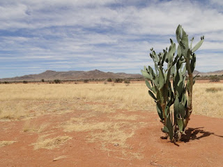
Namibian desert and cactus friend.


Nest of social weaver birds (from a distance and up close). Approximately 100 birds live in a nest this size.


Rich with his box of favourite favourites cookies in the Intrepidmobile.


 Rich hiking Dune 45 just before sunrise.


Dune in the Namib-Naukluft Park.


Sossusvlei, Namib-Naukluft Park.


Camping in the middle of the desert.


We're excited to be driving across the Tropic of Capricorn (especially since Rich is a Capricorn).

Though we’ve been enjoying the sights, we (Carissa in particular) have been struggling a bit with our insulation from the communities we’ve passed along the way. The vast majority of people we’ve come across are other tourists or employees of shops, campgrounds, etc. that largely cater to groups like ours or other individuals traveling overland in this region. It feels odd to have such minimal contact with local people and to have learned nearly nothing about the way of life of people living in the region or to not have tasted many local dishes. This is not so different than road-trips we’ve taken in the US where we visit National Parks, maybe have a meal at a local restaurant but mostly don’t interact with the local people in any significant way. For some reason this feels more unsettling/unsatisfying here.

From the early days of planning this trip we’ve been struggling with the idea of being tourists, and trying to determine whether to visit more countries for less time (seeing the sights but perhaps not learning much about what life is like in any given location) or fewer countries for more time (hopefully gaining greater exposure to and understanding about the lives of people living in each country). Though we’d prefer to do the latter, to this point we’ve been reluctant to cross countries off our ‘to visit’ list. Perhaps after a few more weeks of changing our location daily we’ll be more inclined to do so.