Wednesday, December 30, 2009

Zanzibar


Zanzibar. Sounds exotic, doesn’t it? As one of East Africa’s great trading centers, it has for centuries been a melting pot of Arabian, Indian, and African cultures. As early as the 12th century, the archipelago (made up of Zanzibar and the lesser known Pemba Island) became a key exporter of slaves, gold, ivory, and wood to locations in India and Asia. In return, Zanzibar imported spices, which its subsequently began farming and exporting. Today, 95% of Zanzibar’s population is Muslim. A perfect place for a secular celebration of Christmas.

Stone Town, the main city on the island, is an ancient city with winding narrow streets flanked by 3-4 storey, often crumbling buildings. A few main avenues through the town are wide enough to fit a car, but the majority of the streets are better navigated by motorcycle, bicycle or foot. These tiny lanes are often bustling with women in traditional Muslim dress, men pushing carts stacked high with a variety of goods for sale, children playing marbles in the dirt between ancient cobblestones. A modern grid layout was not a consideration of the urban planners of the 15th century, so on our arrival we worried we would quickly become lost when walking around. Luckily, our worries were in vain and exploring the cobbled lanes while poking our heads into shops became our favorite activity in Stone Town. Elaborate carved wooden doors are common features of residences and businesses throughout the town. We are told that historically a new building had its new door erected first and then the structure built around it.


Rich walking down the streets of Stone Town, Zanzibar.

 
Interesting old building.


Church and mosque side-by-side as seen from the streets of Stone Town.


One of many intricate doorways in Stone Town.

Our arrival in Stone Town marked the third week of an island-wide blackout. The power to the island relies on an underwater powerline from mainland Tanzania that had broken. According to locals we talked to, this was the third time in the last few years the cable has faltered: 4 years ago power to the island was cut off for 2 weeks, and just a year ago the cable was damaged leaving the island without power for 40 days. The word on the streets was that it would be another month before the government determined how long it would be before the cable was repaired.

People (who normally have electricity; there are plenty on Zanzibar who don’t) went about their lives as normally as they could. Businesses, such as hotels, were kept going by petrol-powered generators - an expensive alternative. Our hotel’ generator allowed us to run a fan in our hotel room for a few hours in the evening - a welcome relief from the hot and humid weather.

To escape the heat of Stone Town, we headed to the east coast beach village of Jambiani. The beaches and turquoise ocean were beautiful. If not for the seaweed that commonly amasses on shore this time of year, the white sand would have been the archetype of a perfect beach. We spent one morning snorkeling off the dhow of Captain Haji and saw many beautiful fish, huge sea urchins, and one massive clam (and fortunately no reef sharks).


The view from Jambiani beach.


Jambiani beach is much quieter and more mellow than other more well-known party-beaches on the other side of the island. The beach is lined with small bungalow-style hotels and we had the pleasure of taking long walks on the beach in front of them (really!). In the evening time it was common to weave in and out of the beach soccer games of young men, coached soccer practices of boys, and keep-away games of even younger boys. After dark, we decided that here at the beach there was at least one benefit of the island-wide blackout…floodlights would have ruined the ambience.

To break up the days of lazing on the beach, we took a day trip to Jozani Forest Reserve - an old growth forest and mangrove swamp in the center of the island. During our visit, we huddled under umbrellas while Zanzibar red colobus monkeys huddled under leaves of nearby trees to escape a tropical rainstorm. After a very un-Christmasy Christmas spent on the beach, we returned to Stone Town for a couple more days, one of which was partially devoted to a Spice Tour. Though spices were historically imported to Zanzibar, nowadays there are many spice farms on the island. We strolled through one of these farms while munching on fruits such as breadfruit, pineapple, and rambutan right off the tree, and got to learn about and see the plants from which cardamom, nutmeg, cinnamon, vanilla, and cloves are harvested. After the farm tour we chowed down a locally-prepared meal incorporating many of the spices - it was delicious, and a great way to spend our last day in Zanzibar.


Zanzibar red colobus monkey at Jozani Forest.


Walking through the forest at Jozani.


Carissa rocking some palm-leaf specs.


Nutmeg and mace.


Peppercorns.


Rich before and after his haircut on Zanzibar.


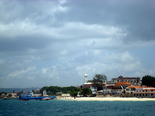
The view of Stone Town from the Sea Bus ferry to Dar Es Salaam.

Sunday, December 20, 2009

A day in the life

Our last post (which was way too long ago, sorry) announced we would be departing Ilha de Mozambique for Pemba, farther north on the Mozambican coast, at the ungodly hour of 3 in the morning. Leaving at this time was necessary to get to the Namialo crossroads before the bus we wanted to flag down (coming from another location) passed that spot on its way to Pemba. Note: no one can give an exact answer when the bus may pass this crossroads - could be 5:30am, could be 7am, could be Tuesday.

We had hoped Pemba would be the gateway to the Quirimbas Archipelago for us.  However after speaking with a travel agent in Pemba we decided that the cost of getting to the white-sand islands was not a good splurge for this trip. Some day, though.

With this decided, it turned out getting to Pemba was the most remarkable thing about it, so here was our day.

2:42 am -- wake up
3:03 am -- continental breakfast (rolls, mango spread, tea/coffee) at our pensao
3:13 am -- call to prayer from the green mosque across the street (and the other mosque across the island)
3:24 am -- Rich (wearing his backpack and should bag) rides on the back of Miguel’s motorcycle across the bridge from Ilha to the mainland
3:35 am -- reaching the mainland, Miguel returns for Carissa; Rich gets into an empty chapa (mini-bus) blaring Lionel Richie tunes
3:46 am -- Carissa’s turn on the motorcycle, which dies part way across the bridge
4:03 am --the chapa is half full and Carissa gets in after walking the rest of the way across the bridge
4:17 am -- the chapa is nearly full and we notice a chicken with its legs bound is being passed in the back door. We simultaneous think “Chicken, don’t pee on my backpack!” and laugh aloud when we realize we’re both thinking the same thing.
4:22 am -- the chapa is full, we depart
5:27 am -- arrival at the Namialo crossroads, vendors race at the sight of our stopping chapa to be the first there to sell their wares
5:30 am -- we take seats on our backpacks along the roadside to await our bus

Carissa sitting on her pack at the Namialo crossroads around 5:40am. The roads are usually this packed this early, partially to avoid the heat later in the day.

5:31 am -- we are invited to a dance party across the street with some guys who apparently had been dancing and drinking all night; we decline, the techno beats and suggestive dancing go on
6:12 am -- first application of sunscreen, it is already hot enough to be sweating lots
6:38 am -- we board our bus, standing room only
7:37 am -- a seat opens up near where Carissa is standing, she gets to sit down
7:54 am -- our bus is struggling up the hills, we are passed by a much newer looking bus from the same company and wonder if we should have waited longer at the crossroads to get on that bus instead
8:01 am -- Rich gets to sit down, luckily next to Carissa
9:58 am -- we wish the five chatty men behind us would quiet down, they’ve been having way too good of a time since we got on the bus, we recognize we are grumpy
10:54 am -- the paved road becomes half-paved
12:01 pm -- colicky baby in front of up spits up on Carissa’s backpack. awesome.
12:52 pm -- we notice the 10-year old boy sitting next to us is “mining for gold” and decorating the wall with the booger harvest. carissa glares at him despite herself.
1:58 pm -- arrival at the bus station in Pemba, Mozambique. begin trying to figure out where to sleep tonight and where we can get some lunch.


Rich eating beef stew and nsima (nshima, ugali, pap) at Pemba Take Away.

Here are a few pictures of a beautiful sunset on the beach in Pemba:


Thursday, December 17, 2009

Elated with Ilha de Mocambique


We only intended to stay on Ilha de Mozambique for 2 nights, but tonight will be our fifth. Though the island is tiny (about 1.5 miles long by 0.25 miles wide) and has few tourist attractions (the old palace which has now become a museum, a few restaurants and places to stay) we have been charmed by its dilapidated beauty, friendly inhabitants, and constant ocean breezes without which the high temperatures and humidity would likely be unbearably (yes, we know most of our readers are rolling their eyes from the chilly northern hemisphere winter at that last sentence, but it’s true!).

Ilha (as everyone calls it, pronounced ee-lee-a) is just 3km off the coast of Mozambique and is a UNESCO World Heritage Site. The first Portuguese settlement on the island was established in 1507. By 1522 a tiny chapel had been built at the far northern tip of the island that, according to our guidebook, is the oldest European building in the southern hemisphere (however our guidebook has told us much mis-information, so any of you history buffs out there feel free to correct us on this.) It was the capital of the former Portuguese East Africa until the late 19th century when it was moved to what is now Maputo (the current capital of Mozambique).

Though many of the large, once-magnificent buildings aren’t that old (we’ve been told many were built in the late 1800s), nearly all of them are crumbling. We suspect heat, humidity, salty sea air, a 15 year civil war and poverty are at least some of the culprits. Regardless of their state, many are being used in one way or another. You’re equally likely to see feral cats in the interior of one and a nicely set up kitchen in the front room of another with children poking their little faces out of cracked doorways or the national flag indicating government offices on the next.


There is a stark contrast between the historic Stone Town – full of crumbling once-magnificent government buildings, churches, and a bright pink palace – and Makuti town on the southern end of the island – where most of the population lives in small thatched-roof homes squashed up one against the other with narrow winding streets from where the voices of children, chickens, and music blares most of the day.


View of Makuti town from our pensao rooftop.


Regardless of where we are on the island, we can always count a pleasant greeting and awkward but non-aggressive stare from one particular man. He is middle aged, wearing worn clothes and has a long black beard. Like one of those characters from a movie who makes a brief appearance in every scene (think Lee Travino in Billy Madison), he appears out of no where no matter where we are on the island. Day or night, he greets us in Portuguese as we try to hide our amusement at seeing him again (and again).

The food has been delicious. Lots of fresh fish, grilled squid, curries are some of our favorites with cocont rice accompanying everything. A local dish, matapa de siri-siri, is a wonderful stew of seaweed (we think), cashews, and peanut sauce. A staple of our diet has become mangoes: little ones, big ones, orange ones, green ones, stringy ones, juicy ones, pureed ones spread on breakfast rolls. We purchase ours from a friendly elderly woman who sells hers from in front of what appears to be her home (in one of the many crumbling old buildings) for only 2 meticais each (about $0.07 each) rather than the going rate of 3 meticais each. These prices make it seem even more ridiculous that we once paid $1.99 for a single mango at Willy St Co-op in Madison in the middle of the winter.

As we type this there are dueling live calls to prayer from two of the mosques on the island, one of which is directly across the street from our guesthouse. According to our guide at the [former palace] museum, Abdul, 95% of the island’s inhabitants are Muslim, 4% Christian, and 1% Hindu (apparently we’re the only agnostics on the island). The mosque across the street’s magnificent, faded green minaret is seen in this picture taken from the rooftop deck of our guesthouse. Though we’re used to it now, the 3:15am call to prayer blaring from the speakers caused us both to sit bolt upright our first night on the island.


Rich on our pensao's rooftop terrace with the massive green mosque is in the background.


On Wednesday Dec 16th we went on an all-day dhow (traditional East African sailboat) adventure with two other travelers (and a crew of 2) to 3 locations near Ilha. We visited the tiny, uninhabited Gao and Sansetien (we're not sure how to spell this one) islands as well as a beach on the mainland across from Ilha. The water and sand were awesome, as were our sunburns after spending 8 hours in the scorching sun (turns out SPF 30 has nothing on Mozambican rays).


View of the palace on Ilha as we departed for our dhow adventure.


The water was a gorgeous, clear blue (as seen here with the frayed edge of our dhow's sail).


Rich lounging on the dhow.


Rival dhow.


Rich munching on his bread and mango sandwich on the mainland beach.


Carissa in the park with one of the massive viney (rooty?) tree.


Sunset on the east shore of Ilha.


Sunset on the green mosque from our rooftop terrace.

Tomorrow we will begin our journey north up the Mozambican coast to Pemba at 3am. Yes, 3am – we have no idea why most of the public transit we’ve encountered in southern Africa leaves at such an unbelievably early hour – why not at least wait until sunrise at 5am?). The first portion of our journey: riding on the back of motorcycles while wearing our backpacks and shoulder bags across the 3km one-lane bridge connecting Ilha to the mainland. Should lead to a good story…

Wednesday, December 9, 2009

Quick update from Mangochi, Malawi

Howdy loyal blog readers.  We apologize for the long delay in posting anything.  We've had minimal access to slow internet broken up by periodic energy black-outs, so the next 3 posts (all posted today) were written on the dates to which they're back-posted.  There are no pictures (the connection would take FOREVER to load them), but we hope to post them as soon as we can.

We're now in Mangochi, Malawi preparing for our approach to Mozambique tomorrow.  It will be the first country we visit where we speak neither the first nor second language of most people (portuguese not english is the official business language).  We're hoping Rich's spanish knowledge will help us out.  That and many gestures.  We're planning to make our way across the northern part of the country to Ilha de Mocambique and Pemba in the next week or so.

We hope to post more about Malawi soon. Enjoy the next 3 posts while we walk back to our leaky hotel in a thunderstorm.

Wednesday, December 2, 2009

Just the two of us

We arrived in Lilongwe, Malawi on Tuesday, 1 December. After 3 weeks in the spacious Intrepidmobile, we’ve really enjoyed using public transit (bus, shared minivan, shared taxi, etc) so far.
On the morning of November 30th at 5:30 am we boarded a bus for a 7-hour trip from Livingstone to Lusaka, Zambia’s capital city. As we waited to leave the station we were afraid of how much ear drum damage we would have by the time we got there as the speaker overhead was pumping out deafening Zambian music. The seats were comfortable (we had seats together on the 2-seat side of the bus) and we felt like we had a lot of room. As we got going the soundtrack changed to a best of Phil Collins and the song “We are the World” before switching to Zambian gospel music. The countryside was beautiful with a mix of scrubland and small farms.

Five hours into the trip, the music stopped abruptly only to be replaced by African nature films with titles such as ‘Royal Blood’ and ‘Cycle of Seasons’ on the onboard video system (which we had not even noticed until this point). We were roused from our tv-watching stupor part way into the second nature film as the brakes began to squeal while were turning left down a rainy hillside. As the bus skidded and nearly tipped over, many on board screamed and we all frantically looked around at each other for cues on how concerned we should be. The bus driver must have been scared too: he stopped the bus as soon as possible to check things over. The brakes and wheels must have been in good enough shape as we soon resumed the trip. Lions continued their struggle to survive on the video screens as we continued on to Lusaka.

The Lusaka bus station was a frantic place with aggressive taxi and mini bus drivers shouting “Big man” and “Boss” at Rich to try to get his attention (and business). With many offers for guidance to whatever we needed, it was hard to tell who to trust and where the scam might be coming from, but we managed to get led to the ticket booth for a bus company that reportedly could get us to our next destination the following day – Chipata in eastern Zambia. We purchased tickets from a somewhat sketchy booth for another seven-hour ride the next morning leaving at 7:30 am with a 7 am boarding.

After an interesting night chatting with fellow travelers at an odd hostel in Lusaka, we returned to the bus terminal the next morning, November 31st. A man who helped us find our bus told Rich, “NPS…it is unreliable, you should not be on it.” By chance we happened to arrive early at 6:40 am and after getting (we are pretty sure) scammed out of 20,000 Zambian kwacha (US$4) to put our bags below the bus, we boarded to find all but three seats filled. We wedged ourselves into the two remaining seats at the very back of the bus between the 4 other passengers already in this row, Carissa with her feet on a box another passenger was transporting with them. Despite our guide’s warnings that the bus was unreliable, the ride was fairly unremarkable through short on space.

There was no music or videos on this ride, but the landscape was pretty. Through Namibia, the desert had transitioned into scrubland as we headed north and everything has been green since Botswana. The big difference in Zambia is the soil. Even in western Zambia, the consistency of soil was largely sandy, but it has been a richer, darker red since entering eastern Zambia. More organic, we suppose. Farm plots are small and people are plowing them with oxen or by hand with hoes, but there is definitely more agriculture. And much more hilly terrain – really beautiful.


One of many road-side markets we passed between Lusaka and Chipata, Zambia.

Chipata is the easternmost city in Zambia on the highway that heads to Malawi’s capital Lilongwe. Bicycles are everywhere. This is the first place we have seen them as a common form of transport in Africa. They all seem to have racks over the back wheel and function as single-occupant taxis or as cargo-haulers. We are also now commonly seeing influences of Islam now—shops that are advertised as halaal, the dress of some people, and the large yellow mosque across the road from our hotel. We don’t know what was said during the live singing of the evening call to prayers from across the street, but it was melodious.


When we arrived in Chipata, Zambia, our bags (and only our bags) tumbled out of the luggage compartment of the bus into a massive puddle of red mud.  Rich is attempting to remove some of the mud from them in this picture.  They are still muddy. 


A new month brings a new country…so on the 1st of December we awoke with the goal of getting ourselves to Lilongwe, Malawi. It was only 130-km away, but with two long days of travel behind us, we were dreading that the border crossing would be arduous. After changing money from Zambian kwacha to Malawian kwacha, we hopped into a shared taxi to get to the border 30-km away. With 6 passengers and the driver in a Toyota Tercel, it was cramped, but not too bad and the trip up the mountain to the border took no time at all. We crossed into Malawi without any trouble, and caught another shared taxi to the small town of Mchinji 12-km from the border. In Mchinji we hopped into a shared mini-bus in Lilongwe. 3 hours total…felt like no time at all. Except for the bus station which was, as expected, a frantic hive of human energy, so far Malawi has been a very friendly and relaxed place.

Thursday, November 26, 2009

Livingstone, I presume

We were expecting the river crossing into Zambia to take anywhere from a 1/2-hour to all-day after we arrived in the Intrepidmobile to wait for the ferry. All the truck traffic that used to go through Zimbabwe on its journey from South Africa to other parts of southern Africa now lines up for this one border crossing as fuel is more reliable in Zambia. We were told trucks wait anywhere from a day to weeks for the appropriate paperwork to get across the ferry into Zambia, and that sometimes after having been there for days the truck drivers may block the road out of frustration. Naturally this would have made our crossing more difficult.


Ferry used to cross Okavango River in Botswana (similar to the one mentioned in this post).

Fortunately, we had had an early start (6:30am) to try to beat the crowds… and it worked. Lickety split we were through Botswanan customs, waited 20-minutes for a ferry for us ,twenty schoolchildren, the Intrepidmobile, and two other cars to board, and we were on the other side in Zambia. Once through immigration, Carissa and I got to see what would become the one souvenir we would most frequently be solicited to buy—Zimbabwean currency. The largest note, One Hundred Trillion dollars, was practically worth nothing even when in use, but since Zimbabwe has abandoned their own currency in favor of the US dollar it has become a popular souvenir (or so the masses of men selling these bills on the street would like you to think).

We followed the Chobe River as it became the ‘mighty Zambezi’ and on to Livingstone, Zambia, where we camped near Victoria Falls. The river and falls separate Zambia from Zimbabwe and unfortunately Zambia gets the short end of the stick. The waterfalls on the Zambian side only flow powerfully in the height of the rainy season and wane between rainstorms. We visited the Zambian side on our arrival. It had been raining for the previous 3 days so the falls looked magnificent (though still a dry season flow).


Rich and Carissa at Victoria Falls (Zambia side).


Victoria Falls (from Zambia).


Us just above where the Zambezi plummets over the falls in Zambia.


Magnificent Victoria Falls.

A few days later when we crossed into Zimbabwe to try out the view from the other side, Zambia’s falls had obviously waned. In contrast, the Zimbabwean side was mighty and massive. Some sections of the falls were 93 meters tall and spray from them obscured the sky even from the opposite lip. There’s a bit of hype around which side of the falls is better, and whether its ‘worth’ the cost of the Zimbabwe visa to see the falls from that side, but our vote is a resounding yes – the views were just more breathtaking.


Devil's cataract (a portion of Vic Falls) on the Zimbabwe side.


Rich swinging from a very strong vine in Vic Falls NP, Zimbabwe.


Carissa and the massive Vic Falls (Zimbabwe side).


Rich just above the Boiling Point on the Zimbabwe side (with the much smaller Zambian falls in the background).


Since Zimbabwe’s tourism has declined in recent years, Livingstone, Zambia has taken on the mantle of Victoria Falls’ main town (replacing Zimbabwe’s Victoria Falls town as the tourist hub). Livingstone is 11-kilometers from the falls and less convenient than the town of Victoria Falls in Zimbabwe which basically overlooks the river. We stayed there in Livingstone for two days after we parted ways from our Interpidmobile friends. Passing up the opportunities to go river rafting or bungee jumping, we instead spent our time looking around the markets and managed to catch a Saturday morning anti-domestic and child abuse rally. Interspersed with dancing, there were speeches and educational skits to hammer home the point.

Our accommodation was a backpackers hostel named Jolly Boys. We’d describe it as a budget resort as it was the nicest hostel at which either of us has ever stayed. It had a friendly staff, great facilities including a pool and bar, and on Saturday night had a traditional drumming and dance show outside the kitchen where we prepared our dinner. Very fancy.

Indeed we’ve cut the apron strings with the Intrepidmobile and are traveling on our own using public transit. We’ll see how this compares...

Tuesday, November 24, 2009

Briefly boating through Botswana

The Okavango Delta of northern Botswana is a 16,000 square kilometer area of beautiful river and creek channels through marshland. The Okavango River begins its journey in Angola and the waters of the rainy season there take three months to make their way through Namibia and into the floodplains of Botswana. We are told that it is the only river in the world that terminates into the middle of a landlocked country; its waters just seep into the Kalahari desert.

Although we experienced some monstrous thunderstorms in northern Namibia, the water from those rains have not yet made it to the Delta so there are fewer lagoons and channels. This was to our advantage.

Our group disembarked from the Interpidmobile and climbed into mokoros (2-passenger, one-poler dugout canoes) to travel to our camp an hour’s journey away. Bayju, our poler, taught us about the birds and trees of the Delta as we cruised among the papyrus stalks and grazing cattle waded in front of us. It wasn’t until we were close to our destination that he revealed to us that the channels we had been travelling through were maintained by hippos, and then we heard them. A big pod of maybe 60 animals were grunting and cavorting in the lagoon near our campsite. After setting up camp (on dry land), we returned to the lagoon to watch the sunset at eye level with the the hippos and crocodiles.


Cow grazing in the delta.


Hippo showing us his teeth before sunset, Okavango Delta.


Sunset from our mokoro, Okavango Delta Botswana.

As we sat around the campfire that night, a lightning storm lit up the sky around us in every direction as if we were in its eye. The rain never came, but the flying termites sure did. We were getting used to these rainy-season visitors by this point: we had watched their evening ritual of emerging from their 6-ft tall nests after dark to mate and head off into the world to make new colonies since leaving the deserts of Namibia. Much like moths, thousands of these 1/2-inch flying insects bombarded us (flying into the backs of our heads) as we sat next to the campfire. Our plan was just to keep them out of our shirts and let them be, but our polers rapidly dug a hole to collect them in for a meal at some other time. We are told they are delicious rainy-season delicacy once pan-fried.

The mokoro was our main way of getting around the Delta and after three days. Once back on the Intrepidmobile we traveled on to Chobe National Park in northeastern Botswana. Chobe is renowned for its elephant herds, so we were excited as these big beasts had eluded us for the most part when we were Etosha National Park (in Namibia). We were not to be disappointed as we found a few herds near the main roads even on our way into the park and our campsite near the Chobe River on the outskirts of the border town of Kasane. On the morning of November 23 we went on an early morning game drive (Beilttog sibs: the vehicles were exactly like the ones from the Indiana Jones ride at Disneyland) where we saw some creatures, but it was the evening boat cruise on the river that really yielded great animal watching. Groups of hippos were up out of the water grazing on the river banks, each with an egret following along to munch up the upturned bugs. Although most of the hippos paid us no mind, it was crazy to see some of them sprint full speed back to the safety of the water, crashing into it with a big Hippo grunt. We were lucky enough to find three groups of elephants down at the river drinking their daily water ration (up to 50 gallons for the big matriarchs), playing in the mud, and socializing. There were quite a few super-adorable baby elephants with their mothers.
Chobe NP and the town of Kasane –near the junction of the four countries of Namibia, Botswana, Zambia, and Zimbabwe – were our last taste of Botswana. From here we crossed the river into Zambia.


Big bull elephant, Okavango Delta.


Baobab tree at the Botswana/Namibia border.


Warthog at our campsite near Chobe National Park, Botswana.


Warthog family cruising the parking lot near the grocery store in Kasane, Botswana (near Chobe).


Hippos (and their egrets) grazing along the Chobe River, Botswana.


Elephants along the Chobe River.